
Places to Visit in Sikkim: A Guide to the Best Himalayan Attractions
The best places to visit in Sikkim, set out region by region. Each entry carries the altitude, the season and the permit notes that decide whether it belongs in your itinerary.
The best places to visit in Sikkim are spread across four districts that feel like four different countries: a walkable capital and a border road in the east, high cold valleys in the north, the state’s oldest monasteries in the west, and hilltop statues and tea slopes in the gentler south.
This guide is organised the way you would actually travel: by region, with driving times and permit requirements attached, so you can see which combinations fit the number of days you have. For the practical detail behind it — how permits are issued, what the seasons do to the roads, what to pack — see our Sikkim travel information page.
Best Places to Visit in Sikkim by Region
Four districts, and what each one is actually for.
East Sikkim
Gangtok as a base, Tsomgo Lake and Nathu La on a permit day, and the monasteries within an hour of town. Where most first trips start.
North Sikkim
Lachen, Lachung, the Yumthang valley and Gurudongmar. The highest and most demanding half of the state, and the one that needs the most days.
West Sikkim
Pelling, Pemayangtse, the Rabdentse ruins and Yuksom. Sikkim’s oldest layer, with the state’s closest road views of Kangchenjunga.
South Sikkim
Namchi and Ravangla — hilltop statues, temple complexes and the Temi tea estate, on gentler roads at lower altitude.
Places to Visit in Gangtok & East Sikkim
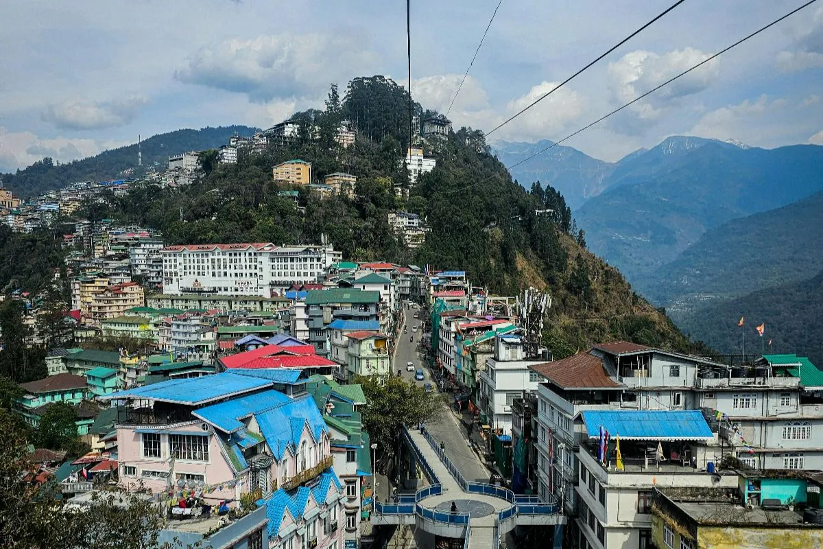
The capital sits at about 1,650 m on a long ridge, and almost everything below is within a two-hour drive of it.
MG Marg
Gangtok’s central promenade is closed to vehicles, swept clean and lined with benches, cafés and shops. It is also a no-smoking, no-littering zone, which the town enforces. Most hotels in central Gangtok are within a five-minute walk, and it is the one place in Sikkim where an evening with no plan works perfectly well.
Come here on your first evening rather than your last — it is the easiest way to settle before a high day.
- About 1,650 m
- Open all year
- No permit needed
- Pedestrian only
Rumtek Monastery
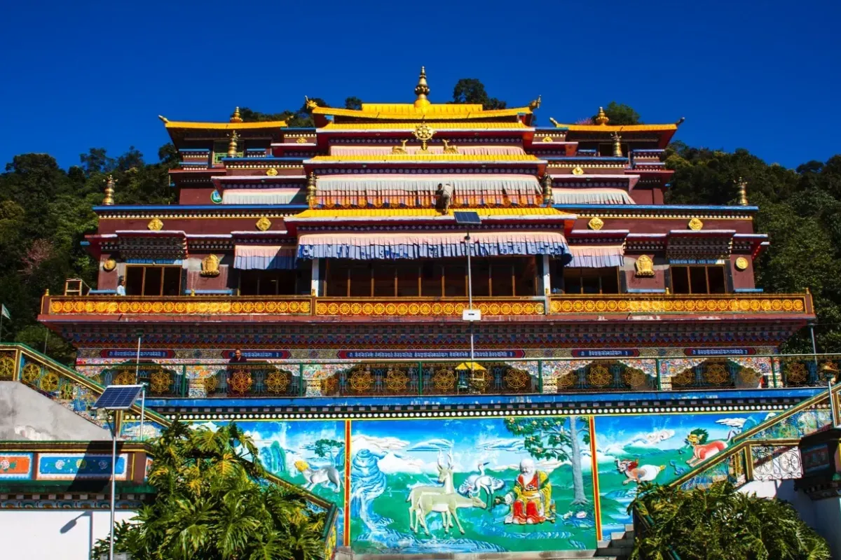
Roughly 24 km from Gangtok, on a ridge facing the town across the valley, Rumtek is the seat in exile of the Karma Kagyu order and the largest monastery in Sikkim. The main shrine, the golden stupa and the monastic college sit inside a walled complex that takes an unhurried hour or two.
Carry photo identification — the complex is security-checked. Mornings are quieter and the light on the painted facade is better.
- About 1,550 m
- Open all year
- No permit needed
- 45 min from Gangtok
Tsomgo Lake
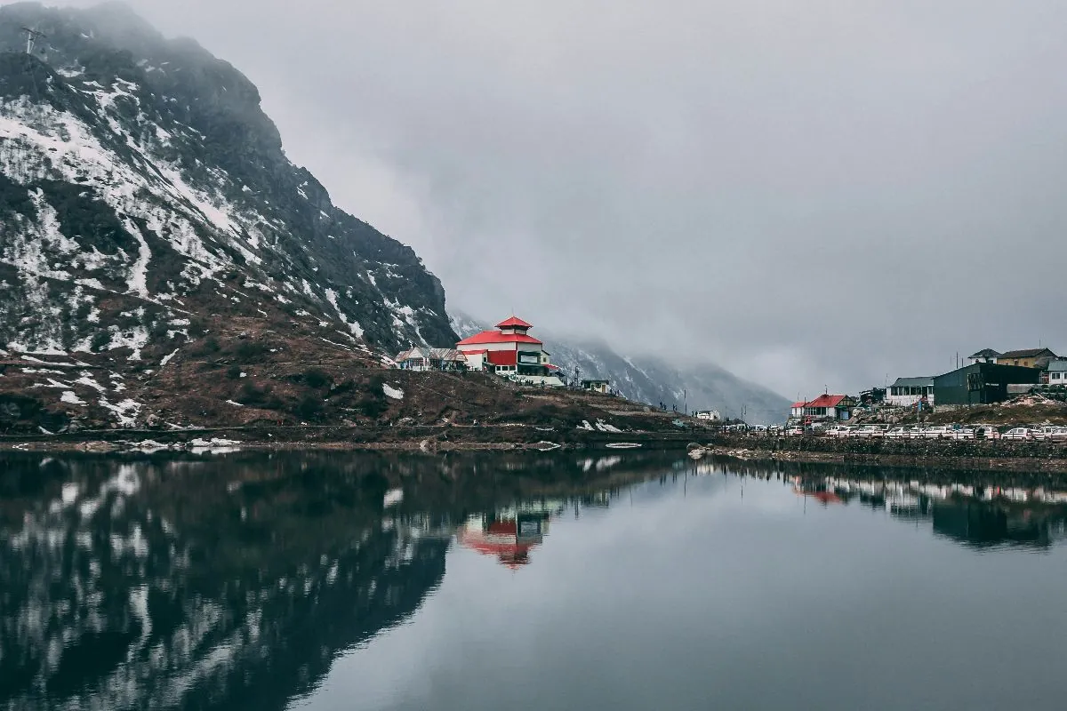
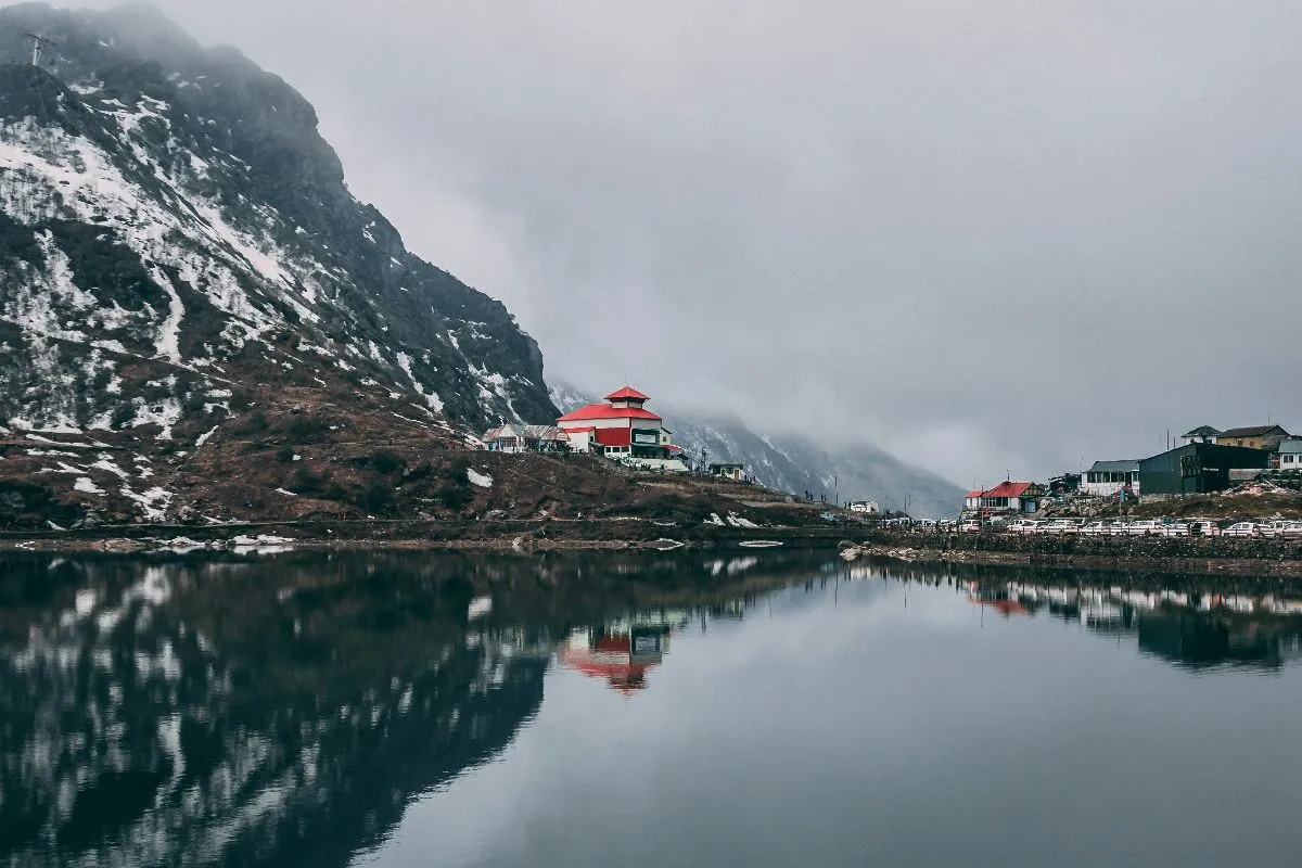
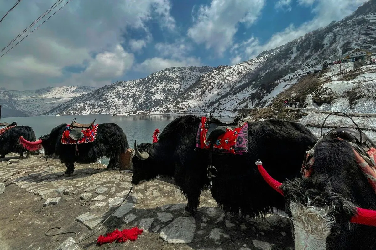
Tsomgo, also written Changu, is a glacial lake about 40 km east of Gangtok at roughly 3,753 m. It freezes over in winter and turns a hard green as it thaws. Yaks wait along the shore, there is a short prayer-flag walk above the water, and the whole thing sits inside a protected area.
This is a serious altitude gain from Gangtok in a single morning. Keep the visit short, drink more water than you feel like, and treat any headache as a reason to go down rather than push on.
- About 3,753 m
- Permit required
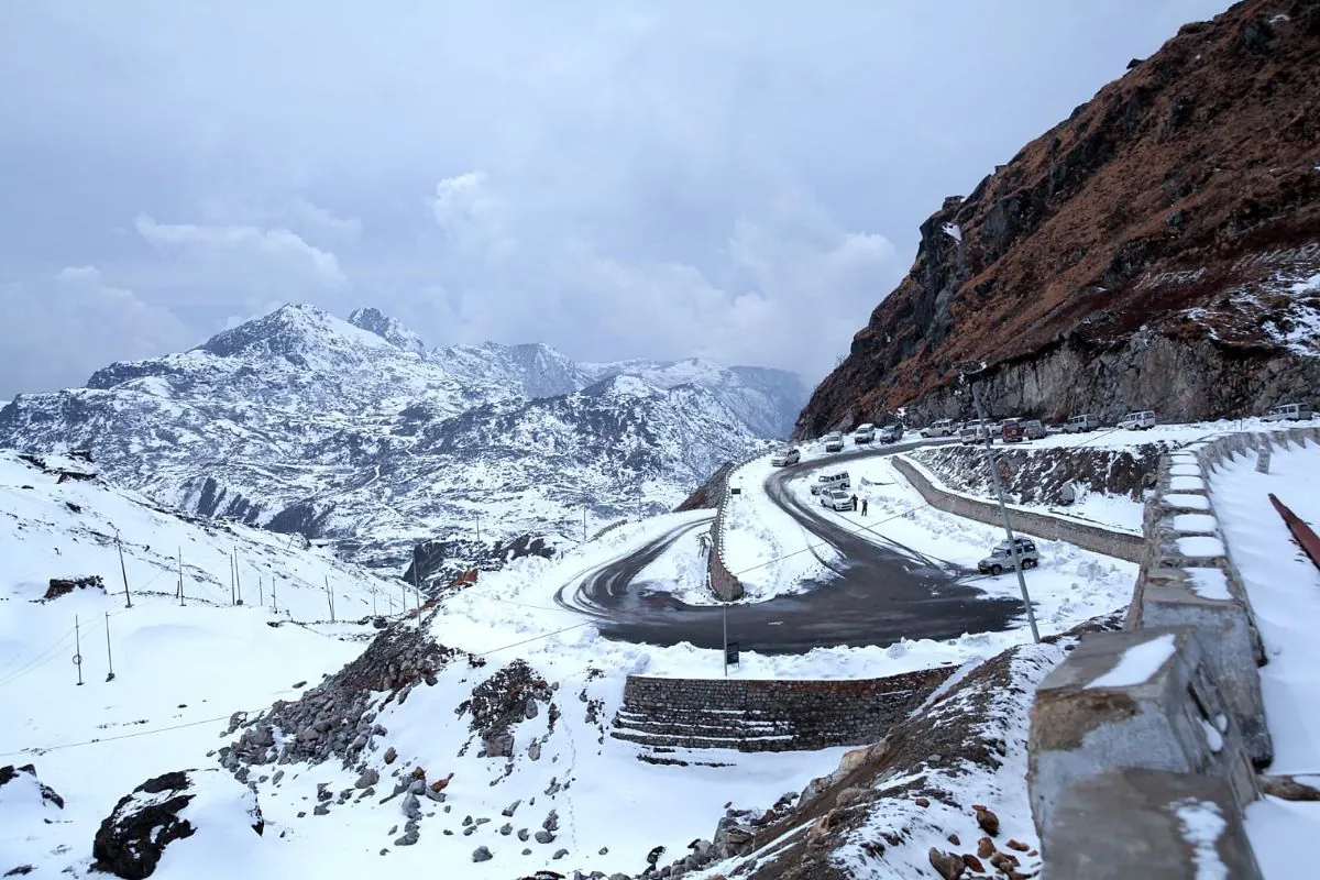
- Road can close in snow
- 2 hrs from Gangtok
Baba Mandir and Nathu La
Beyond Tsomgo the road continues towards the border. Baba Mandir, at roughly 3,900 m, is a shrine to Baba Harbhajan Singh, an Indian Army soldier, and is maintained by the Army. Nathu La itself sits at about 4,310 m on the old trade route into Tibet.
Nathu La comes with real conditions attached. It is open to Indian nationals only, closed on certain days of the week, and can shut at short notice for weather or border reasons. The traveller permit and the vehicle permit come from two different offices. No operator can guarantee access, and you should treat it as a bonus rather than the reason for the trip. Current rules are published by Sikkim Tourism.
- About 4,310 m
- Indian nationals only
- Permit required
- Closed some days
Places to Visit in North Sikkim
The highest country in the state, reached on long driving days from Gangtok. Everything here depends on permits, on snow, and on how your party handles altitude — so read the notes rather than only the photographs.
Lachung
Lachung is a village at roughly 2,700 m, about six hours north of Gangtok, and it exists on most itineraries as the overnight stop before the Yumthang valley. Rooms are simple, power can be intermittent and heating is basic — this is a mountain village rather than a hill station.
The drive up follows the Teesta through Chungthang. Plan on arriving late afternoon and doing nothing else that day.
- About 2,700 m
- Permit required
- Overnight stop
- 6 hrs from Gangtok
Yumthang Valley
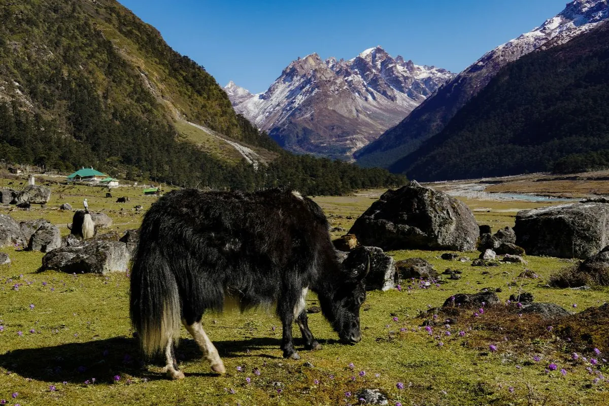
About 25 km beyond Lachung at roughly 3,564 m, Yumthang is a broad grazing valley with the Teesta running through it and snow peaks on both sides. It is often called the valley of flowers, and from late March into May the rhododendron sanctuary on the approach earns that.
The road is usually closed by snow from around December to March. Mornings are clearer; by early afternoon cloud often fills the valley.
- About 3,564 m
- Best late March to May
- Snow closure in winter
- Permit required
Zero Point (Yumesamdong)
Roughly 23 km beyond Yumthang, at about 4,700 m, the road simply stops. That is Zero Point. There is snow for much of the year, no shelter, no facilities and very little oxygen.
It is an optional extension, never a guarantee — the road closes for long stretches of winter and can shut at any time in fresh snow. We would not recommend it for young children or for anyone who has already found Yumthang hard going.
- About 4,700 m
- Often closed December to March
- No facilities
- Optional extension
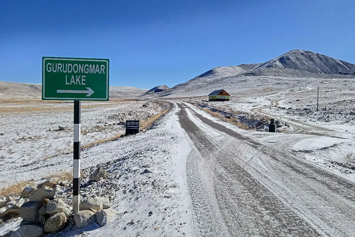
Lachen and Gurudongmar Lake
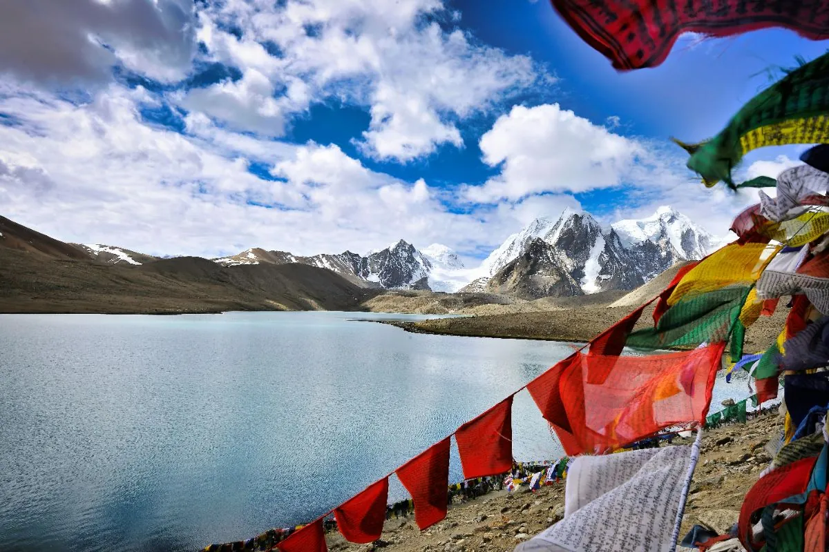
Lachen, at about 2,750 m, is the northern equivalent of Lachung and the base for Gurudongmar. The lake itself lies at roughly 5,430 m — high enough that the run is made very early in the morning and kept short.
Gurudongmar is open to Indian nationals only; foreign passport holders are permitted as far as Thangu. Snow closes the road for much of the winter. This is the single most demanding thing on any standard Sikkim itinerary, and it is worth being honest with yourself about whether your party should attempt it.
- About 5,430 m
- Indian nationals only
- Permit required
- Very early start
Places to Visit in West Sikkim
The oldest ground in the state, and the easiest place to see Kangchenjunga from a road rather than a trek.
Pelling and Pemayangtse Monastery
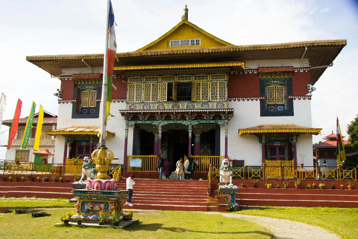
Pelling sits at about 2,150 m and is essentially a viewpoint with hotels attached — on a clear morning Kangchenjunga fills the northern skyline. Pemayangtse, a short drive away, is one of Sikkim’s oldest and most important monasteries, and its upper floor holds an extraordinary carved wooden model of the celestial palace.
West Sikkim’s weather is kinder than the north’s, and it suits travellers who want mountains without the altitude.
- About 2,150 m
- Open all year
- No permit needed
- 4–5 hrs from Gangtok
Rabdentse Ruins
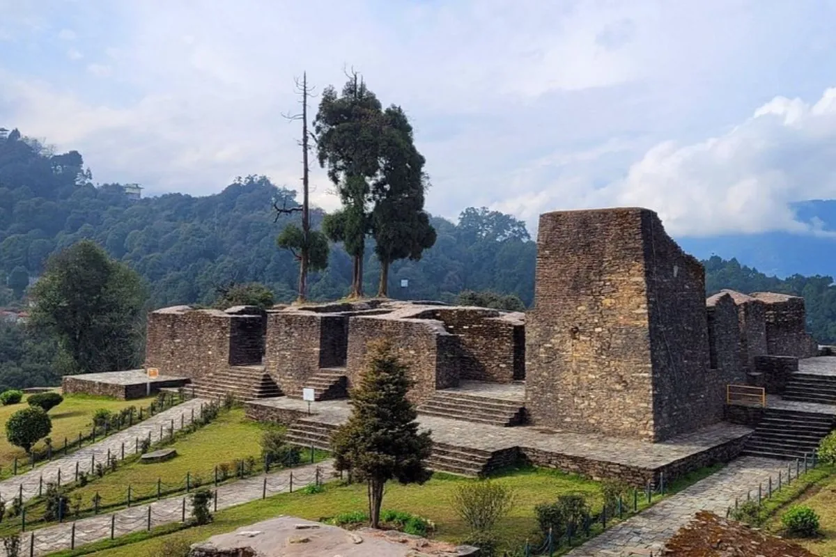
Rabdentse was the second capital of Sikkim, and what remains of it sits on a ridge about 3 km from Pelling, reached by a level walk of ten or fifteen minutes through forest. The site is quiet, protected, and looks straight out at the Kangchenjunga range.
Go in the morning — cloud usually fills the valley by midday, and the view is the point.
- About 2,100 m
- Short forest walk
- Open all year
- Best in the morning
Khecheopalri Lake
A forest lake at roughly 1,700 m, sacred to both Buddhists and Hindus and approached on a short walk from the road. Local belief holds that leaves are never allowed to rest on the surface. It is a quiet, low-altitude stop that pairs naturally with Yuksom.
- About 1,700 m
- Open all year
- No permit needed
Yuksom and Dubdi Monastery
Yuksom was the first capital of Sikkim and is the trailhead for the Dzongri and Goecha La treks. Dubdi, reached by a steep walk above the village, is generally held to be the oldest monastery in the state. Both reward an unhurried half day.
- About 1,780 m
- Trek permits filed by agencies
- Steep short walk
Places to Visit in South Sikkim
Lower, warmer and gentler on the driving — the part of the state that suits families and older travellers best.
Namchi
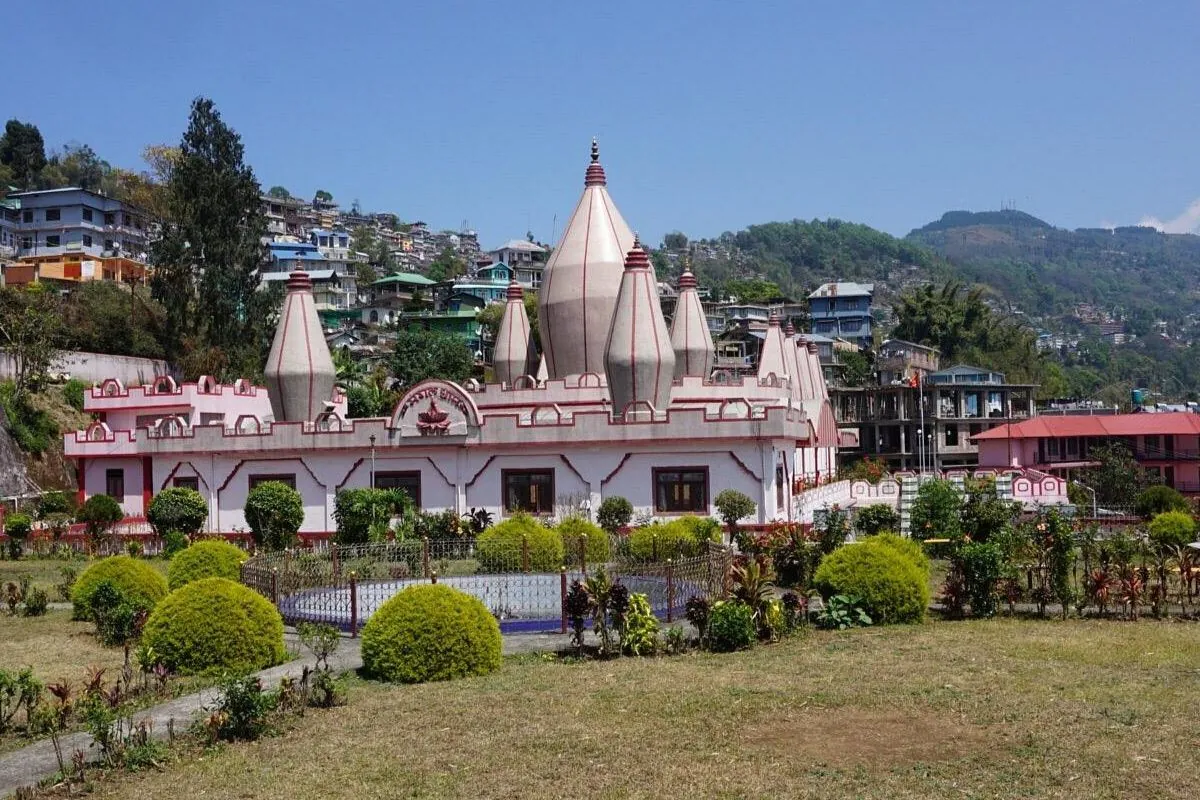
Namchi is the district headquarters of south Sikkim and the base for two large hilltop projects: the Guru Padmasambhava statue at Samdruptse, and the Char Dham complex at Solophok, which gathers replicas of four major Hindu pilgrimage sites on one ridge.
It is an easy stop between Gangtok and Pelling.
- About 1,675 m
- Open all year
- No permit needed
- Gentle roads
Ravangla and Buddha Park
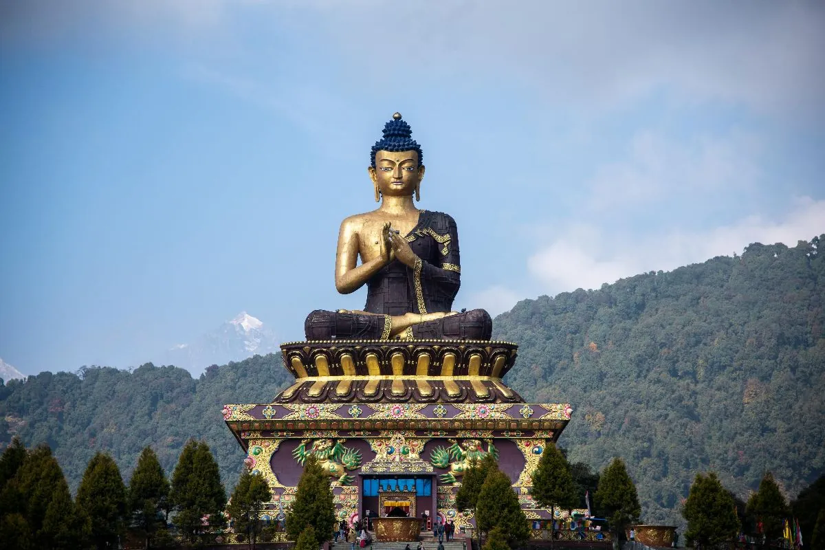
Ravangla sits at roughly 2,100 m on a ridge with the Kangchenjunga range laid out to the north. Buddha Park — Tathagata Tsal — is built around a tall seated Shakyamuni Buddha in landscaped grounds, and the walk around it is flat and unhurried.
The Temi tea estate, the only tea garden in Sikkim, is a short drive below and makes an obvious pairing.
- About 2,100 m
- Open all year
- No permit needed
- Good for families
Best Time to Explore Sikkim
There is no single best month. There are months that suit different trips, and months that quietly close half the state.
March to May
Rhododendron and magnolia through the middle hills, and the north Sikkim valleys reopening. Mild days, cloudy afternoons. The best window for Yumthang.
June to September
Monsoon. Green, quiet and much cheaper, with a genuine risk of landslide delay on NH10 and mountain views that come and go.
October to November
The clearest skies of the year and the best mountain views. Peak season — hotels and permits both need booking well ahead.
December to February
Cold, bright and empty. Snow closes the highest roads; Nathu La, Gurudongmar and Zero Point are the first to go and the last to reopen.
How Many Days Do You Need for Sikkim?
The commonest planning mistake here is trying to fit north Sikkim into a short trip. These are the combinations that actually work.
- 4 days — Gangtok, local sightseeing and one permit day to Tsomgo Lake
- 5 days — The same, unhurried, with Rumtek and the monasteries added
- 6 days — East and west Sikkim — Gangtok, Tsomgo and Pelling
- 7 days — Adds south Sikkim: Namchi, Ravangla and the Temi slopes
- 8 days — The first length at which north Sikkim and Lachung fit properly
- 9 days — North and west together, with Lachen for a gentler climb
Those map onto the 3 Nights 4 Days Sikkim Tour, the 5 Nights 6 Days Sikkim Tour, the 7 Nights 8 Days Sikkim Tour for Lachung and Yumthang, and the 8 Nights 9 Days Sikkim Tour to add Lachen.
Sikkim Sightseeing FAQs
Which places to visit in Sikkim need a permit?
Tsomgo Lake, Baba Mandir, Nathu La, Zuluk and all of north Sikkim beyond Chungthang need a Protected Area Permit. Foreign nationals also need an Inner Line Permit to enter the state at all. Both are issued through registered agencies, so they must be arranged before you travel.
Can foreign nationals visit Gurudongmar Lake and Nathu La?
No. Gurudongmar, Nathu La and Zuluk are open to Indian nationals only. Foreign passport holders can travel to Tsomgo Lake in the east, and to Lachen, Lachung and the Yumthang valley in the north, applying through a registered agency in a group of two or more. Rules change, so confirm the current position before booking.
Is Zero Point always open?
No. Yumesamdong, usually called Zero Point, sits at roughly 4,700 m and the road is regularly closed by snow between about December and March, and occasionally at other times. There are no facilities and no shelter at the top. We treat it as an optional extension rather than a guaranteed part of any itinerary.
How many days do you need to see the main places in Sikkim?
Four days covers Gangtok and one permit day east; six covers east and west Sikkim. North Sikkim genuinely needs eight or nine, because Lachen and Lachung are overnight villages rather than day trips.
Which part of Sikkim suits older travellers or young children?
South and west Sikkim. Namchi, Ravangla and Pelling sit between roughly 1,675 m and 2,150 m with shorter driving days and long mountain views, and none of them require the sustained altitude gain of the north. Anyone with a heart or lung condition should take medical advice before considering Gurudongmar or Zero Point.
When do the rhododendrons flower in Sikkim?
Broadly from late March into May, moving up the hillsides as the season warms. The Shingba sanctuary above Lachung is the best known display and Barsey in west Sikkim is quieter. Timing shifts by a few weeks each year.
Travel information last reviewed: September 2026. Permit rules and access conditions can change; please confirm current requirements with us before you travel.
Build These Places Into a Trip
Tell us which of them matter most to you and how many days you have. We will put them in a workable order, with the permits each one needs.